Geographic Information Systems (GIS) Certificate
Overview
In the last few years, many state agencies have created new positions for people with Geographic Information Systems (GIS) training. Oklahoma agencies that employ persons with GIS certificates include the Conservation Commission, Department of Forestry, Department of Transportation, and Department of Commerce. Native American tribal governments, city planning departments, and regional planning agencies have also created positions for GIS specialists. There is a demand for GIS analysts in federal agencies such as the U.S. Fish and Wildlife Service, National Park Service, Bureau of Land Management, U.S. Forest Service, Natural Resource Conservation Service, and the Environmental Protection Agency. In addition, there is a demand for GIS professionals in private industry such as surveying and engineering firms, petroleum and natural gas companies, and utilities such as electrical and gas.
This GIS Certificate requires students to complete 15 credits (5 classes) earning a minimum of a C in every course. Three of the five classes are required while the remaining two courses are chosen from the other three GIS courses offered. All required courses are available online; elective courses may be online, hybrid, or face-to-face.
Required courses:
- GEOG 3813 Geographic Information Systems (every fall)
- GEOG 4833 Advanced GIS (spring, even)
- GEOG 4853 GIS Automation & Scripting (spring, odd)
Choose two of the following GIS Skill-focused courses:
- GEOG 4053 Cartography (fall, even)
- GEOG 4803 Intro to Geospatial Technology (spring, even)
- GEOG 4873 GIS Field Applications (spring, odd)
For more information about degree requirements, visit the NSU catalog.
Current students, to enroll in the GIS Certificate program, contact Academic Advising.
Certificate Available at
- Tahlequah
- Online
Transferring to NSU?
Make your transition to NSU as smooth and seamless as possible.
Visit Transfer Student Services for more information.
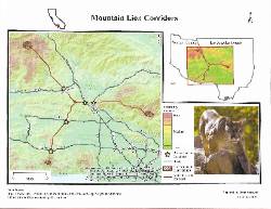
Student Created Map of Mountain Lion Corridors
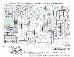
Student Created Map of the Customers Effected by the Norman Waterline Break


